 The Hole-in-the-Rock Road, five miles east of Escalante on Route 12, is an unpaved, gravel road that travels 57 miles southeast following the Straight Cliffs on the west side of the Escalante River. At the end is a wedge-shaped slice in the rock (the Hole in the Rock) with a view of Lake Powell. Most of the road can be driven by a two-wheel vehicle in good weather. The last six miles, however are very rough and may require a four-wheel-drive vehicle.
This is a dead-end road and you must return the same way, though there are some four-wheel side trips and loops you can make from the road. A drive to the end of the road and back with no side trips or lengthy stops will take about four hours.
You can plan a brief side trip from Route 12 to the Devil’s Garden (12.5 miles), a worthwhile photo visit, and then continue your trip along Route 12. If you are interested in hikes and exploring more of the road, you will need at least a full day and more if you want to take some longer hikes.
If you only have time for one full day hike, do the hike to the Dry Fork of Coyote Gulch. There are four excellent slot canyons of extraordinary beauty here, all quite close to each other. The easiest and first you’ll encounter is the Narrows of the Dry Fork. The others will require more hiking and climbing skills.
If you decide to drive the entire road and are looking for an excellent day hike, put Willow Gulch with Broken Bow Arch on your list next. If you have several days, the most popular hike is the Hurricane Wash hike to the Escalante River. This will require an overnight backpack.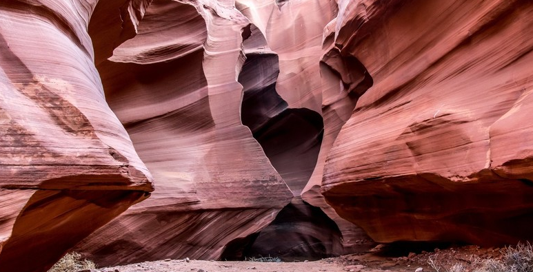
Harris Wash
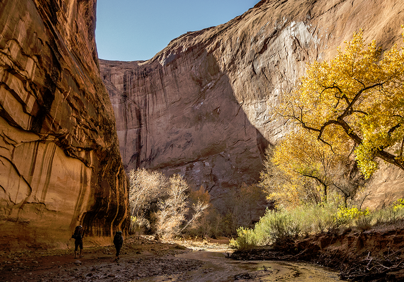
It is about 10 miles from the beginning of the Hole-in-the-Rock Road to the turnoff to Harris Wash. The Harris Wash Trail is one of the easiest access routes to the Escalante River. To reach the Trailhead, take the side road east seven miles. This is a good road and you shouldn’t have any problems in good weather with a passenger car. The hike down the wash eventually enters a canyon with high patina-stained walls. It is 10 miles to the river. You should allow a full day but two are better.
Devil’s Garden
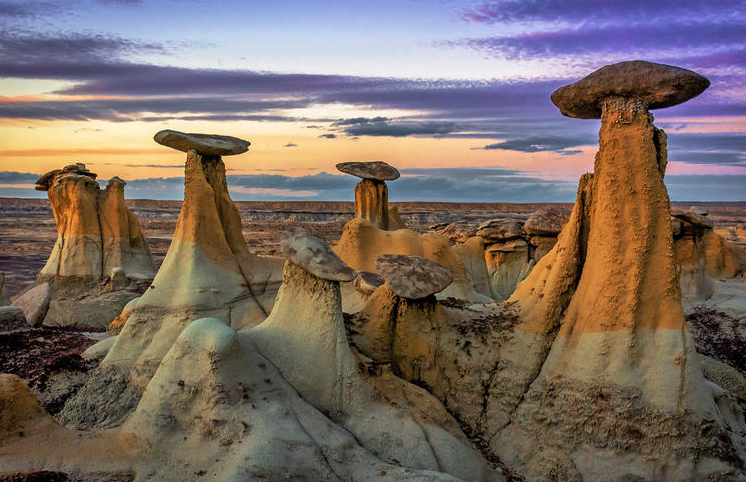
Continuing south on the Hole-in-the-Rock Road you come to the Devil’s Garden turnoff, about 12.5 miles from Route 12. Turn right (west) and drive the half mile to the parking area. This is one of the best and easiest to reach destinations of the Hole-in-the-Rock Road and worth a side trip from Route 12 even if you do not intend to go farther. Here you’ll find arches and a collection of sandstone formed into
interesting and unusual sculptures. There are no formal trails here yet-you just wander around. Some of the more interesting features are south from the parking area.
Dry Fork of Coyote Gulch
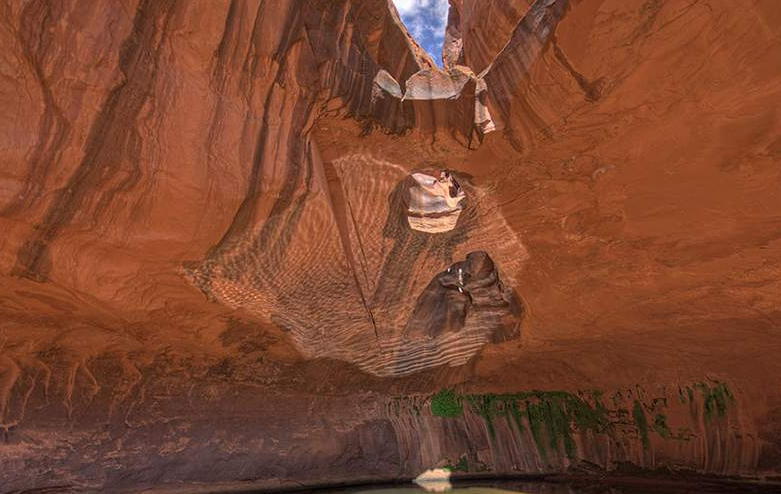
If you have an extra day, and don’t mind the hike, put the Dry Fork of Coyote Gulch on your list. There are four beautiful slot canyons here. The easiest and first is the Narrows of the Dry Fork, then followed by aptly named Peek-a-boo, and then Spooky. Peek-a-boo and Spooky are very tight canyons not for the claustrophobic. Brimstone, the fourth is more difficult and should be attempted only by avid
slot canyon photographers with good hiking skills.
At Mile 24 you come to the Early Weed Bench turnoff, an alternative but not preferred route to the Dry Fork of Coyote Gulch. The best and more popular route is at Mile 26.6 where you will come to a lone forked juniper tree on the right side of the road. Right after this tree take the next left (east). This is a rough road, but should be passable by street vehicles in dry weather. Two roads fork to the right but continue to bear left until you have traveled 1.7 miles to the parking area. You can camp here if you wish to spend some time in the area.
From the parking area you must hike down another half mile to the Dry Fork of Coyote Gulch and the first of the slot canyons. It is a moderately strenuous downhill route through sandy washes and over slickrock. As you descend the canyon head for the sand dune to your left and follow the drainage down to the Dry Fork of Coyote Gulch. Narrows of the Dry Fork of Coyote Gulch
When you reach the bed of Coyote Gulch turn left (upstream). The walls of the wash narrow dramatically into a slot canyon. These narrows continue for about a half mile and are the best choice for photographers who are carrying a lot of equipment and are not that athletic. Of the four slots in this area, this one is the easiest to enter and it is an easy stroll up canyon.
Peek-a-boo Gulch
Continuing downstream (to the right) you come to a series of slot canyons that drain into the north side of Coyote Gulch. Hike down Coyote Gulch about five hundred feet to Peek-a-boo, the first and a very unusual slot canyon but it is a challenge to enter and negotiate some of the passageways. If you have time and are willing to work for your photos, you will find this slot, with its interesting curves, very rewarding. You have to climb up to Peek-a-boo Gulch, although some steps cut into the rock help. Peek-a-boo is well named. It is a series of convoluted holes and tunnel-like passages that require some
agility to get through. This slot is not for the claustrophobic. It may be difficult to get into this slot if there has been recent rain because of water pools. The back end of the narrows of Peek-a-boo is the most interesting but require squeezing through some narrow passages.
Spooky Gulch
About a half mile down canyon from Peek-a-boo is a sandy wash leading to Spooky Gulch. Spooky takes a bit of squeezing to get through and has more linear forms. This slot is also not for the claustrophobic or anyone with a very heavy build. You can walk right in but this deep slot is very narrow in places requiring that you squeeze your way between very high walls along much of its length. The upper rim of the
slot closes in, making this a dark canyon so you might want to do some light painting with your flash.
Brimstone Gulch
Continue down the Dry Fork of Coyote Gulch. You will hike through some narrows that is blocked by a chockstone that you must climb over. The return is a lot more difficult. The next canyon down the Dry Fork is Brimstone Gulch and this takes a bit of hiking to reach and navigate the narrows. You must hike about a mile up a wide canyon to the narrows. Here the canyon closes into to a narrow slot for about a half mile. Negotiating through the narrows can be difficult because of pools of water and chockstone obstructions.
The agencies in the area can provide you with detailed information on these hikes and can brief you on any changes. Rushing torrents of water formed these canyons and these same waters can remove or add obstacles.
edwell and Chimney Rock
Thirty miles from the start of the Hole-in-the-Rock Road is the turnoff to the Redwell Trailhead. This is an alternate route to the popular Coyote Gulch hike and is a lot less crowded than the preferred Hurricane Wash route. To reach the trailhead, turn left and drive 1.5 miles. This is a fair road with a washout near the end. The trail is 13 miles to the Escalante River. Much of the walk is easy but you may
encounter log jams that are significant obstacles. You reach the Dry Fork of Coyote Gulch in about 1.5 miles. You continue down the Dry Fork until it merges with the Hurricane Wash route covered below.
Back on the Hole-in-the-Wall Road continue south to the Chimney Rock turnoff at Mile 32.4. The side road (to the east) goes 2.4 miles to a view of a rock spire.
Hurricane Wash and Coyote Gulch
This is a popular hike leads to some outstanding features including several waterfalls, a natural bridge and several arches. It ends at the Escalante River. The parking area is alongside the road at Mile 33. The trail starts a quarter mile down the wash to the east. It is five miles to Coyote Gulch and 12 miles to the Escalante River along this route. The hike is a moderate one with most stretches being easy.
You will be walking in shallow water part of the way, so you will want to bring appropriate foot gear. Obtain information from local agencies on the obstacles you might encounter on this hike and the best ways around them. Most of the landmarks of photographic interest are toward the end at the lower section of Coyote Gulch where the steep walls of the canyon are stained with desert varnish and water seeps create hanging gardens of ferns. The first major landmark is Jacob Hamblin Arch, followed by Coyote Natural Bridge and Cliff Arch. You will then pass several waterfalls. You can get a view of Stevens Arch
across the Escalante River toward the end, but you will need good trail directions and to also know the flood stage of Lake Powell, which can back up the Escalante River when it is high.
Fortymile Ridge
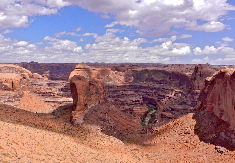
At Mile 35 you come to the junction of the road to the Fortymile Ridge Trailhead. The access road is five miles to the trailhead and you should have a four-wheel drive vehicle because of the washouts and deep sand. This is a short (2-mile) but strenuous hike over slickrock and sand to the rim of the lower Coyote Gulch Canyon, the Crack-in-the-Wall (a very narrow passageway) and the Escalante River. From the rim you have outstanding views of the distant Henry Mountains and rock formations of lower Coyote Gulch Canyon. The highlight of this hike is a view of Stevens Arch. From the Crack-in-the-Wall walk down a large sand hill into Coyote Gulch. To get closer to the arch, you must wade across the Escalante River and there is a lot of vegetation on the other side. As mentioned above, sometimes Lake Powell is flooded into this region.
Dance Hall Rock
Dance Hall Rock is a huge sandstone amphitheater to the left (east of the road at Mile 37). It was so named because the flat floor of the hollowed-out sandstone made an excellent place to hold dances when the road was first being built.
Willow Gulch
Continuing south you will descend into Sooner Wash at about Mile 40 with rocks on both sides. At Mile 42 is the turnoff (to the left) to the Willow Gulch Trailhead. Drive 1.5 miles to the end. This short (3-miles one way) moderate hike is one of the most rewarding photographically. The highlight of the hike is Broken Bow Arch, a massive arch that can be effectively photographed from several angles, including from the higher sides of the canyon.
Hole in the Rock
Fifty-seven miles from Route 12, the road ends at a V-shape cut in the rock (the Hole in the Rock) that can be used to frame views of Lake Powell with the formations of Cottonwood Canyon across the lake. This view is best in the afternoon.
